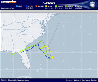
 (Jacksonville, FL) Initial model trends send the disturbed area of weather, east of Florida, northward. High pressure should then act as a blocking feature, forcing the tropical system either westward or eastward and NOT towards the Carolinas. Keep in mind that the system is still in its formative stages, and at this point anything could happen.
=> Stay updated on tropical weather anytime of the day- Sign up for the mailing list.
Comments