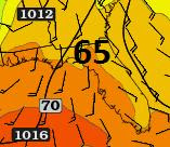
Severe weather is possible tomorrow night (Wednesday Night thru Thursday Morning). There is a possibility of two lines of severe weather. The first line will contain the strongest storms. The second line will provide the heaviest rainfall.
The first storms should pop up around the area from 8:30-10:30 PM. The second line could resemble more of a bow echo line. (Bow echo lines are associated with straight line winds) Rainfall totals will vary greatly across the area. An average of .50 inches of rain is a good bet. Locations that find themselves under severe thunderstorms could pick up 2+ inches of rain in a short time period.
The area that will be most susceptible to supercells will range from eastern Texas to South Carolina. Southern Georgia and areas west of Lake City are included in this high risk area.
There are several reasons why there could be SEVERE thunderstorms in the area:
First: Dew points will be on the high side, for this time of year. (Dew points likely around 65 degrees.)
Second: Temperatures from 70-74 degrees.
Third: Precipitable water content will be 1.25 to 1.75 inches (moderate moisture content). P.W. is the amount of moisture that exists in the complete vertical column, above our heads.
****What has me most concerned: EHI Values will be from 1-1.98. This index combines both CAPE and helicity. Both are associated with the amount of potential spin in the atmosphere.
What should provide better answers on whether severe weather will be possible is the launch of the a weather balloon, tomorrow morning, around 7:30 AM.
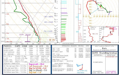
This is what New Orleans looked like earlier today (they saw numerous tornadoes nearby):
The first storms should pop up around the area from 8:30-10:30 PM. The second line could resemble more of a bow echo line. (Bow echo lines are associated with straight line winds) Rainfall totals will vary greatly across the area. An average of .50 inches of rain is a good bet. Locations that find themselves under severe thunderstorms could pick up 2+ inches of rain in a short time period.
The area that will be most susceptible to supercells will range from eastern Texas to South Carolina. Southern Georgia and areas west of Lake City are included in this high risk area.
There are several reasons why there could be SEVERE thunderstorms in the area:
First: Dew points will be on the high side, for this time of year. (Dew points likely around 65 degrees.)
Second: Temperatures from 70-74 degrees.
Third: Precipitable water content will be 1.25 to 1.75 inches (moderate moisture content). P.W. is the amount of moisture that exists in the complete vertical column, above our heads.
****What has me most concerned: EHI Values will be from 1-1.98. This index combines both CAPE and helicity. Both are associated with the amount of potential spin in the atmosphere.
EHI Legend:
| >0.5 EHI > 1 | Severe Weather Likely Supercell potential |
| 1 to 5 | up to F2, F3 tornadoes possible |
| 5+ | up to F4, F5 tornadoes possible |
What should provide better answers on whether severe weather will be possible is the launch of the a weather balloon, tomorrow morning, around 7:30 AM.
This is what New Orleans looked like earlier today (they saw numerous tornadoes nearby):


Comments
Beautty website. Thnx!
[url=http://www.my.dirty.night.de.vu]mydirtyhobby livecams[/url]
[url=http://www.vx-private.de.vu]mit erotik geld verdienen[/url]
[url=http://www.echte-sexkontakte.com/?sub=11421&popex=1]sexfilme Für Paare [/url]