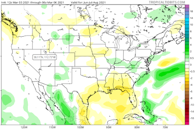
The 2021 summer is looking to be warmer and drier than average across Northeast Florida. An average day during a summer usually sees lows start out in the low to mid 70s followed an afternoon high in the lower 90s. Each month usually sees more than a half a foot of rainfall.
A dry June usually helps the landscape become conducive for the development of wildfires. This especially seems to be the case along the I-10 corridor for the 2021 summer. The wet winter in North Florida will only help to increase the fuel vegetation, which wildfires need to grow quickly.
To recap, watch for a dry and warm June, followed by a warm July with an increase in precipitation. In August we'll try to recoup some of the rain we missed out on during June and July, and the month will likely see more precipitation than average. The increase in August's rainfall will likely keep temperatures down around normal, to slightly below for the month.


Comments