A cold frontal boundary will reverse the trend of near record high temperatures. For the majority of the remaining week, temperatures will be at or slightly below average. Average temperatures for this time of year usually climb from a low of 48 to a high of around 70 degrees. Large portions of the eastern third of the nation will face a similar fate. Colder air could prevail so much that isolated pockets of snow could form in the higher elevations, along the East Coast.
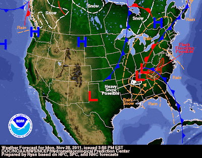 |
| Second Significant Cold Front Of Year Barrels Through East. |
Precipitation amounts have not been impressive, even though this area of low pressure is a powerful storm system. The stark contrast in temperatures just goes to show the power that this accompanies this storm system. Temperatures have already dropped more than 30 degrees in many areas, including here in North Florida.
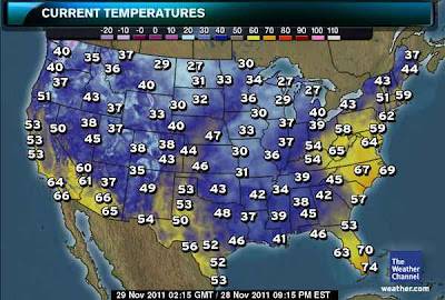 |
| 30's for lows and 50's for highs across much of the country these next few days. |
The cold air will not stay around long because there isn't a significant layer of snow on the ground, yet, in the Continental 48 states. Snow acts as an conveyor belt for cold air. Without it in place, cold air from Canada is not able to stay for long in the lower 48. So, with this particular cool down, expect low and high temperatures to be below average for the next 3 days, followed by more seasonal temperatures.
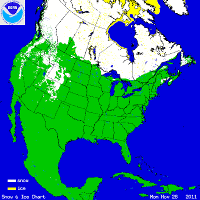 |
| Conveyor belt of snow not existent at this point of the season. |


Comments