
May of 2021 will go down in the records books as the 11th coolest ever in Jacksonville. 65% of the days reported an average temperature that was below normal. In fact, May saw the furthest below average temperatures since December of last year. The cool weather was caused by a ridge of high pressure that was either centered over the area or over the western Atlantic.


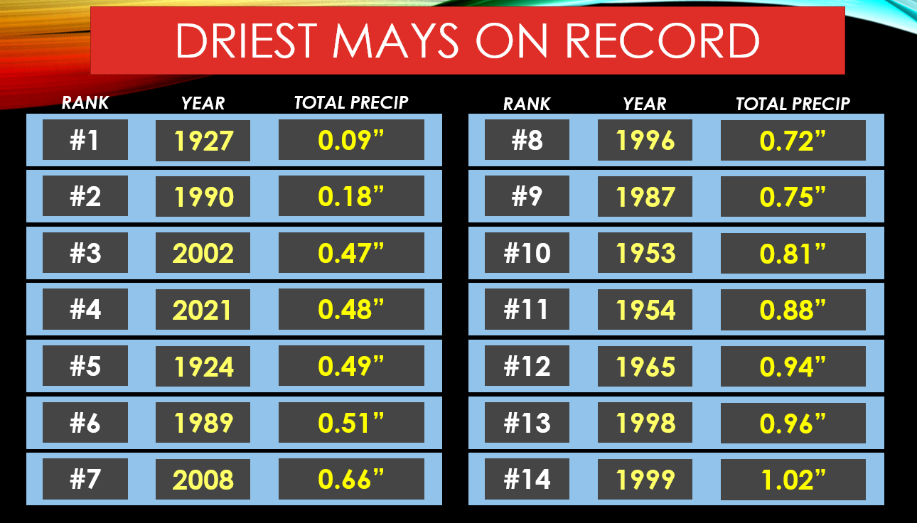
Jacksonville set a daily sea level pressure record on the 21st at 1028.6. This was the fifth highest pressure of all-time during the month of May. The high pressure also forced fronts to avoid entering the Southeast, which caused the Jacksonville to experience the 4th driest May in history. The area only saw 15% of the normal month’s rainfall. Usually during May some 3.22 inches of rain falls. Jacksonville only saw .48 inches of rain.
The dry weather helped spawn several small wildfires during May. The largest of which happened in St. Johns County from May 17th until the 20th. Some 700 acres burned in what was known as the Oscar Ashton Fire. It is believed the fire started from a small prescribed burn, and it eventually burned out of control. No homes were damaged or destroyed. Luckily, the fire burned in a rural area of St. Johns County near County Road 208, near Switzerland.

The dominant easterly flow also was responsible for a heighted risk of rip currents at area beaches. The month saw several periods of increased risk and double red flags warning swimmers to beware. Unfortunately, at least 2 people died at local beaches because of the rip currents. The deaths from the rip currents were the first of 2021 for the area.
Because of the cool spring, our yearly average temperature is not too far
above average. A summer pattern shift will likely cause temperatures to rebound
later in June. It's important to note that cool springs are usually followed by active hurricane seasons. We'll be on lookout to see if this is again the case in 2021.
Comments