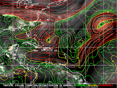
Our quiet tropics are about to turn active. All of the ingredients are lining up for the development of our next cyclone in the Atlantic basin. The MJO (Madden-Julian Oscillation) is heading towards a favorable phase, a pulse of upward velocities will soon be over the basin and shear levels aren’t too restrictive. MJO phases 8, 1, 2 and even 3 usually lead to an increase of activity in the Atlantic Ocean, Caribbean Sea and Gulf of Mexico.
All being said, the week will likely end without a named storm forming in the Atlantic basin. We are in a waiting mode to see what disturbances Africa produces. A basin that is seeing plenty of development is the eastern Pacific. There is a likelihood that that 3 cyclones will form within a 2 week period, off the western coast of Central America.
The next cyclone that’ll form in the Atlantic basin will earn the name ‘Fred’. So far, the Atlantic season has only seen 1 hurricane develop. Over the next few weeks we’ll likely increase this total as we head towards to peak of the hurricane season. The statistical peak of the hurricane season is in mid-September.


Comments