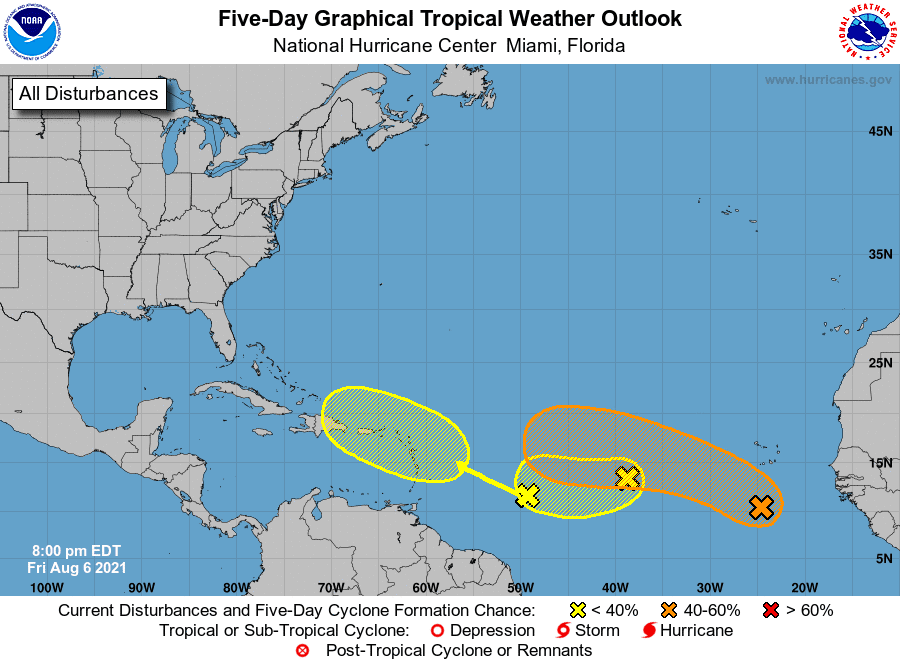

The wave with the highest chance to develop has been given the designation as 92L. The disturbance is currently heading westbound and is entering the central Atlantic. The wave has been slow to develop and that will continue because of its proximity to the monsoon trough. The wave cannot gain its own closed circulation until it separates for the belt of moisture that extends for several hundred miles in the eastern and central Atlantic.

The disturbance should be able to pull away from the trough this week and develop into a tropical depression and maybe even a tropical storm. If it were to organize enough and have winds of more than 40 miles per hour, the system would gain the name of “Fred.” Even if development occurs, the system would still be several hundred miles from the closest land mass. Any threat to the Caribbean Islands would be after August 15, if at all.
Elsewhere in the tropics, no development is anticipated
during the next week. We will, however, have to monitor another tropical wave
that push off the coast of Africa. Seeing several disturbances in the Atlantic is normal for this time of year. We are in the ramp up to the peak of the season in September.

Comments