
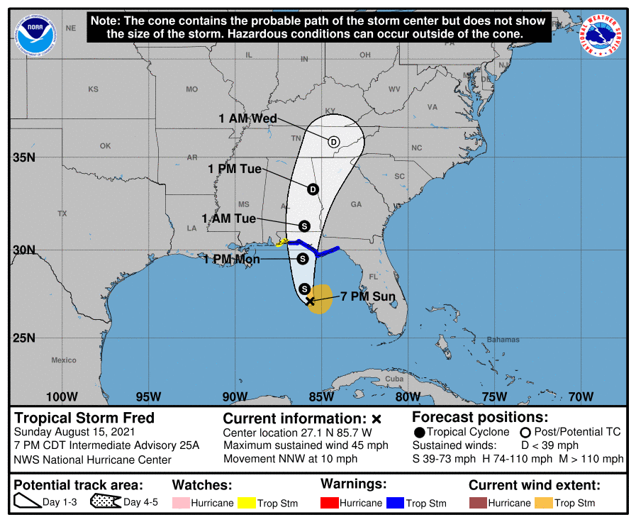
There are plenty of features to monitor over the next week throughout the Atlantic Basin. Tropical Storm Fred is of most immediate concern and will make landfall along the Florida Panhandle as a tropical storm. None of the systems being monitored are expected to immediately become significant cyclones.

Fred has truly never has gotten his act together. The system has been
influenced by the proximity to land. From the beginning, Fred was never
expected to be much a wind threat, just a significant water event. And this
will turn out to be the case for much of Florida and the Southeast. After Fred’s
landfall in the western Panhandle, it really doesn’t have any place to go. And
its remnants could linger around for most of the week.

The second system to watch is Grace. Grace, similar to Fred, has never really gotten its act together. That being said, it’ll eventually be an issue that areas of the western Gulf of Mexico will have to deal with. How strong the system will get is still up for debate, but we shouldn’t if it is able to ramp up before landfall in either Mexico or Texas.

The third system to watch is disturbance #96L near Bermuda. This system is
quite small and the only land mass it’ll threaten will be Bermuda. If it does strengthen
into a tropical storm, its name would be “Henri”. Similar to Fred, the system
could get stuck by a ridge of high pressure, and we might still be tracking the
feature for more than a week.
Finally, a system that’ll emerge off the African coast could
strengthen into “Ida”. Similar to the previous disturbances that have emerged
from the continent, it’ll be slow to develop but will certainly be one to
monitor. This disturbance, which has yet to emerge from the coast of Africa is
likely to be the first major cyclone of the year.

Comments